 History Of Fire in the Malpai Region History Of Fire in the Malpai Region
Fire has played a natural role in maintaining the health of the native vegetation of the Malpai region for millenia. The best evidence for the history of fire comes from fire scars in the rings of ponderosa pine trees. Researchers at the University of Arizona Tree Ring Laboratory have collected fire history data from trees across the Southwest, from Sonora, Mexico, to southern Colorado, including mountains in the Malpai area. All of these trees tell the same story: fire burned across this country routinely every five to ten years, with only occasional spans greater than fifteen years with no fire. In fact, during a dry year following wet years, which can also be determined from tree rings, extensive fires burned in virtually every mountain range across the Southwest simultaneously. Evidence for the pervasive historic influence of fire is also found in the sediments of boggy cienega wetlands in the valley bottoms, where charcoal fragments preserved for thousands of years support the conclusion that fires burned frequently across the valleys from one mountain range to another.
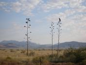
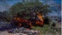
One of the important ecological roles of fire was to prevent woody species such as mesquite and juniper from spreading across the grasslands. Perennial grasses resprout vigorously following fire, keeping grassland productivity high, but fire kills most tree and shrub seedlings. It is common for deer, pronghorn antelope, and even bighorn sheep to move into recently burned areas to feed on the abundant new growth.
The frequent occurrence of fire ended in the late 1800’s with the advent of large herds of livestock whose grazing reduced fine fuels. Roads and trails also broke up fuel continuity, and finally active fire suppression by government agencies in the 20th century attempted to put all fires out. As a result, we have seen a dramatic, and on-going, increase in woody plants that compete with grasses and eventually eliminate most perennial grass cover. This shift from grasses to woody species results in loss of vegetation productivity, erosion of soil, and loss of grassland-dependant animals, many of which are declining throughout the West.
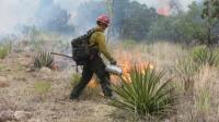
This trend toward loss of grassland can be reversed by returning fire to the landscape through careful application of prescribed fire. However, there is a threshold of grassland deterioration beyond which restoration is difficult or impossible, so immediate management action is needed to restore our grasslands while we still have tracts that are large enough to be ecologically sustainable.
|
|
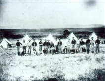
A Cavalry unit in the 1870’s camps near Astin Spring. Note the predominance of grasses.
C.S. Fly Photo |
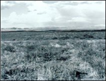 |
Astin Spring 1994, rephotographed by MBG board member and science advisor Dr. Ray Turner. Note the great increase of woody shrubs |
Managing fire in a big landscape the size of the Malpai region requires close collaboration between a variety of public and private partners.
“Our experience shows the effectiveness of the private sector taking the lead to begin the process of coordinated planning and management action. A good example is the reintroduction of fire into our natural communities. Despite widespread acceptance of the need to reintroduce fire into the natural ecosystems of the Southwest, the maze of conflicting and overlapping regulations seemed even to the agencies to be a gridlock too tough to overcome. We have proved to the toughest critics that private sector leadership works by completing the first approved fire prescription ever for the Borderlands region, ending over 80 years of fire suppression. It involved two states, four private landowners, two BLM districts, two state land departments, the Forest Service, the Game and Fish departments in two states, the U.S. Fish and Wildlife Service, a proposed Wilderness Study Area, the Endangered Species Act, and the Antiquities Laws, and coordination with Mexico.” - Bill McDonald
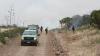
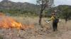
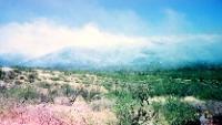
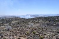
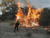
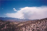
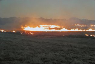
Here are highlights of recent burns in the Malpai Region: |